
SGMS - Smart Gas Management System
Undefined
Geo Web Starter, a project started in 2004, is an innovative web tool of the Istituto Guglielmo Tagliacarne composed of statistical and cartographic databases, which contains over 10 million pieces of information at municipal, provincial, regional, European and international level.
SAS® for Open Data is the platform that allows public and private entities to approach open data publication projects in an effective and efficient way, also guaranteeing users greater autonomy and simplicity in the management of the entire publication process.
SAS® for Open Data allows you to:
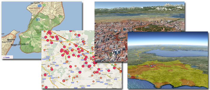
Geomarketing, which can be considered a specific branch of Geo Business Intelligence, is a marketing approach that uses information related to the territory (georeferenced data) to analyze, plan and implement marketing activities. Geomarketing includes several of very different functionalities that concern a wide range of public and private users.
Sistemi Territoriali has provided, in the last few years, specialized support in geomarketing for projects inherent:
GeoBusiness Intelligence is the use of spatial analysis, typical of GIS systems, in Business Intelligence environments, in order to understand the phenomena observed in a territorial context. GeoBusiness Intelligence has been active in the company since 1996, but geographic Business Intelligence systems have been developed by company personnel since the 1980s in research activities of the CNR.
2 giorni
L’orario previsto per lo svolgimento delle giornate di corso è fissato dalle h. 9.00 alle h. 18.00.
3 giorni
The GIS (short for "Geographic Information System") is a powerful set of tools to collect, store and recall if necessary, transform and represent spatial data from the real world (Burrough, 1986).